O
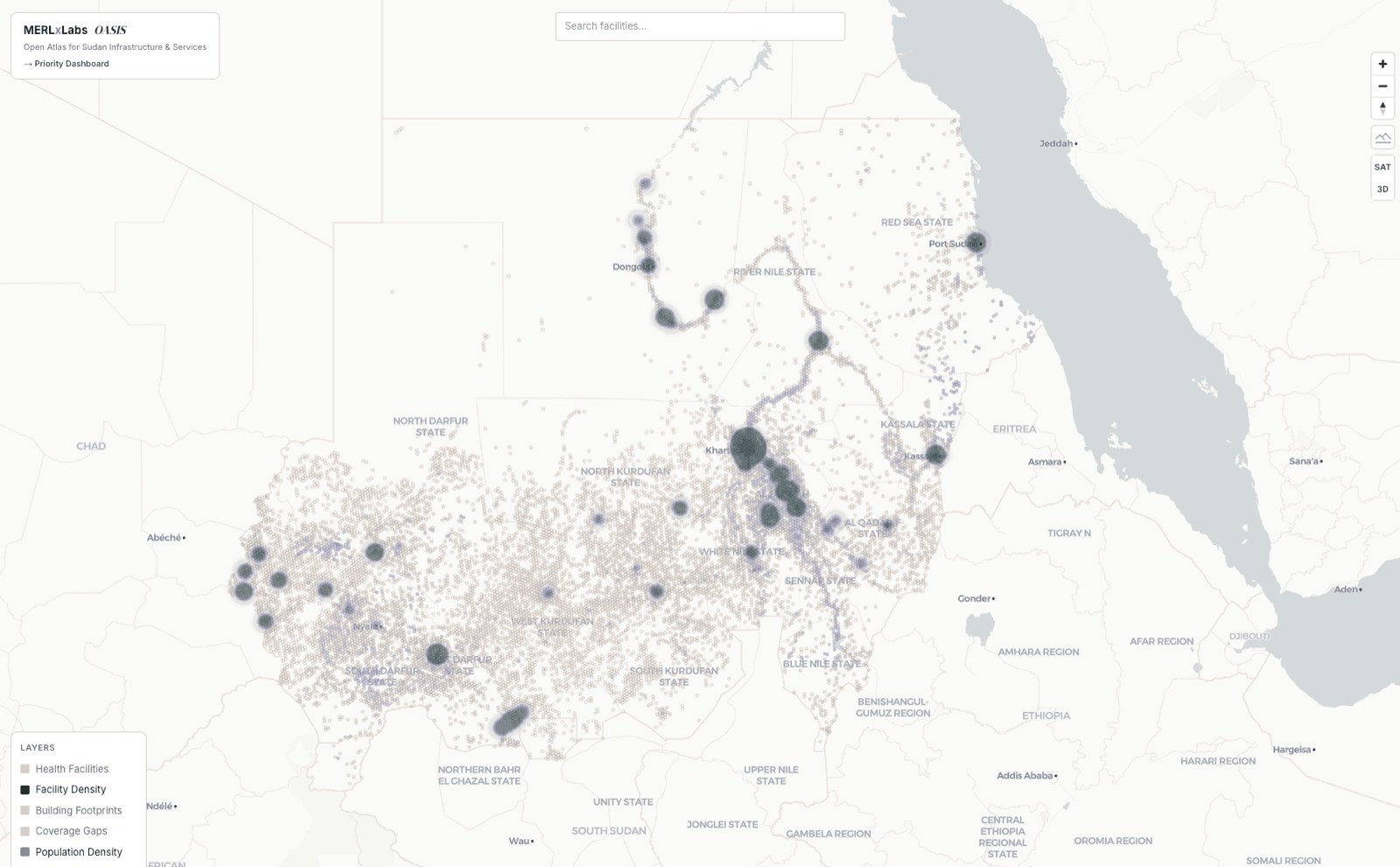
OASIS
Open Atlas for Sudan Infrastructure and Services
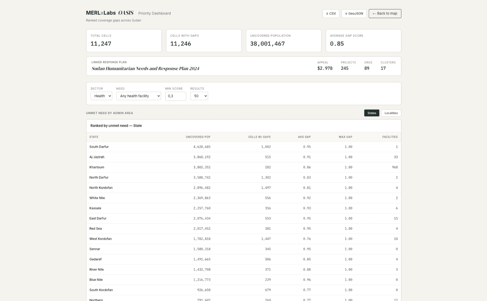
Where to go first, ranked.
Geospatial infrastructure for post-conflict recovery planning. OASIS pulls in facility, activity, displacement and response data, scores coverage gaps on a hex grid, and ranks where programme planners should go first.
Capabilities
What it does.
Capabilities listed here are present in the current build. Performance figures, model cards and annotation protocols available under NDA.
- ·Ingests facility, activity, displacement and response data from open humanitarian sources and client feeds
- ·Deduplicates facility records across sources and scores them against configurable need profiles
- ·Distance-decay coverage scoring on an H3 hex grid, ranked to a priority list of where to go first
- ·Admin-level rollups and spatial joins to any country's COD-AB boundaries
- ·CSV and GeoJSON exports for direct use in QGIS, ArcGIS and downstream dashboards
Built on
Python·FastAPI·PostgreSQL / PostGIS·GraphQL·Next.js·MapLibre·deck.gl