A
Aperture
Satellite and earth observation
Satellite analysis for non-specialists.
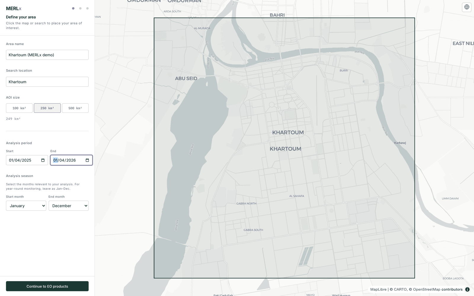
Satellite analysis for programme teams who don't run a GIS. Click a location, set a date range, and get an environmental and situational read back as a PDF report.
Capabilities
What it does.
Capabilities listed here are present in the current build. Performance figures, model cards and annotation protocols available under NDA.
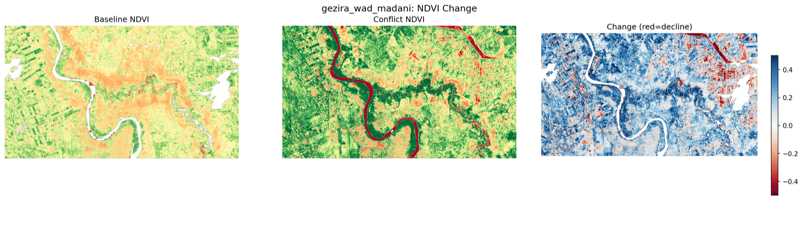
- ·Vegetation (NDVI): cropland productivity, green-cover change
- ·Surface water (MNDWI): flood extent, reservoir change
- ·Built-up area (NDBI): settlement expansion, displacement sites
- ·Radar backscatter (SAR): all-weather structural change
- ·Fire activity: active fires and burn scars from FIRMS / VIIRS
Built on
Python·FastAPI·Copernicus openEO·rasterio·geopandas·Claude
HuggingFace Spaces is used for demo and beta access. Production engagements deploy on client-nominated infrastructure.